Whidbey Island WA 1910

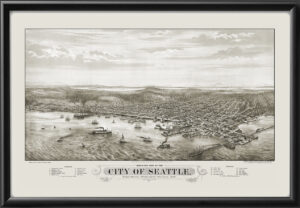
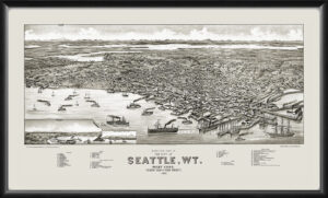
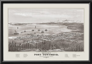
Restored bird’s eye view map of Whidbey Island in Puget Sound, Washington, 1910 by Henry Epting.   The island is shown from the north, with Fidalgo Island, Camano Island, Everett, Seattle, the Olympic Peninsula, and Mt. Rainier also visible.  Towns include Coupeville, Saratoga, Sandy Point, and Langley.

$44.95

SKU N/A Category Tags ,

Description

Our maps are shipped to you unframed. We show them as low-resolution, framed images for illustration purposes only.

Additional information

Size

24×36

0
    0
    Your Cart
    Your cart is emptyReturn to Shop

    Search Products...

    The results below are a partial list of maps, for a full listing please visit Shop by State or Shop by Country.