vintagecitymaps@gmail.com
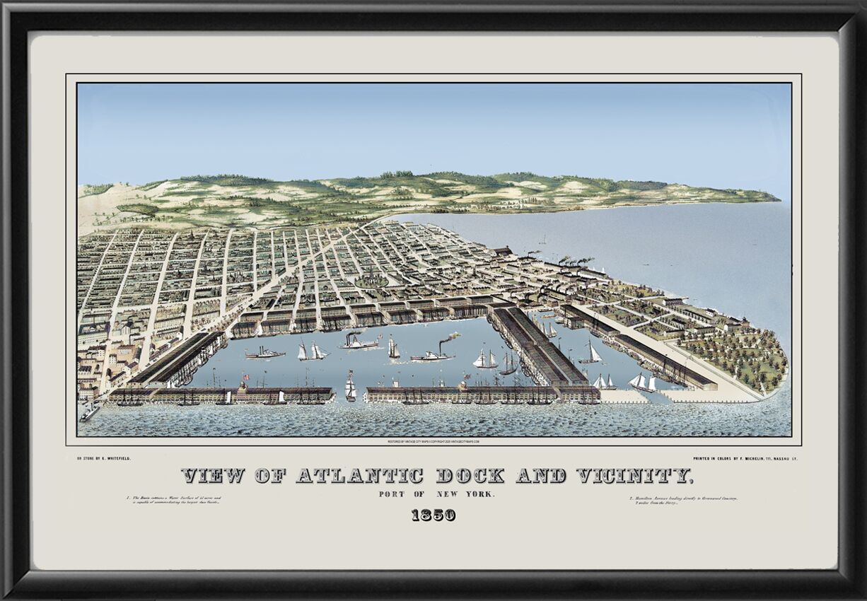
Restored bird’s eye view map of Atlantic Docks and Vicinity, Port of New York, 1850 showing Red Hook and Carroll Gardens, and Brooklyn in the background by Edwin Whitefield
$44.95 – $49.95Price range: $44.95 through $49.95
Our maps are shipped to you unframed. We show them as low-resolution, framed images for illustration purposes only.
16×24, 24×36
The results below are a partial list of maps, for a full listing please visit Shop by State or Shop by Country.