vintagecitymaps@gmail.com
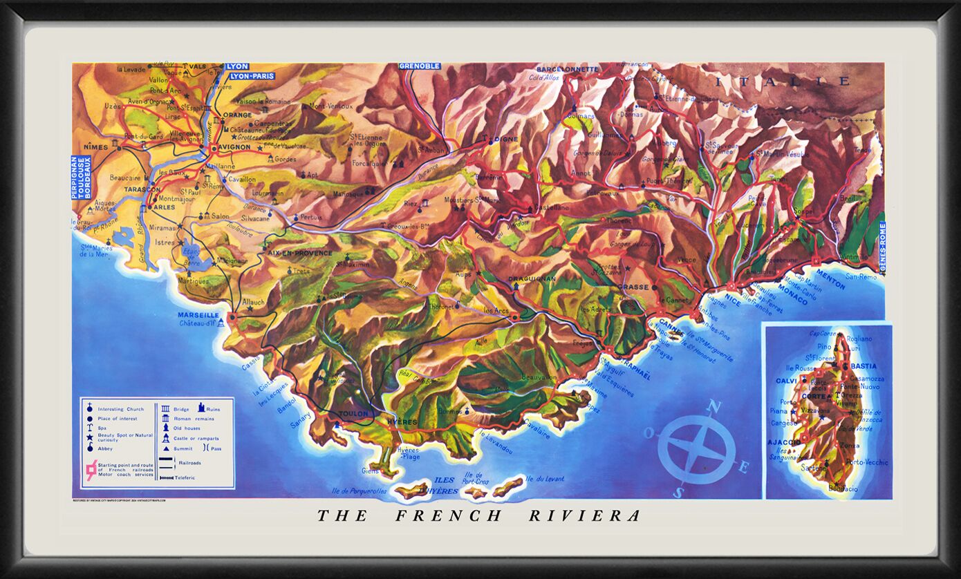
Restored panoramic bird’s eye view of the French Riviera & the island of Corsica, extending from the areas around Avignon to Monaco. Published by the French National Railroad, 1951.
$44.95 – $49.95Price range: $44.95 through $49.95
Our maps are shipped to you unframed. We show them as framed images for illustration purposes only.
14×24, 24×40
The results below are a partial list of maps, for a full listing please visit Shop by State or Shop by Country.