Description
Our maps are shipped to you unframed. We show them as low-resolution, framed images for illustration purposes only.
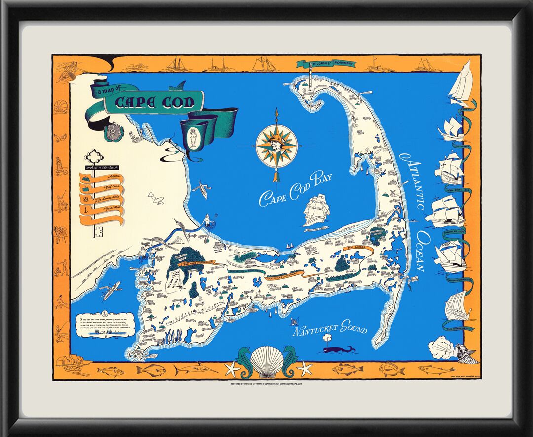
Restored pictorial map of Cape Cod, Massachusetts, 1940 by Paul Paige, showing towns, points of interest, lighthouses, sporting and recreational activities, ocean fish and different types of sailboats. The map also has depictions of ships of some early explorers and settlers including a Viking ship, the Mayflower, and the vessels of John Smith and Champlain
$39.95 – $74.95
Our maps are shipped to you unframed. We show them as low-resolution, framed images for illustration purposes only.
Size | 20×24, 24×30, 36×45 |
---|
The results below are a partial list of maps, for a full listing please visit Shop by State or Shop by Country.