vintagecitymaps@gmail.com
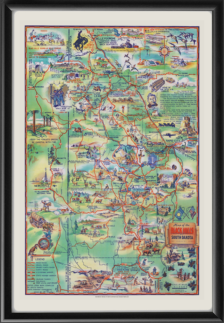
Restored bird’s eye pictorial map of the Black Hills region of South Dakota, produced in 1940 by K. Pyle to promote tourism throughout the area in the 1940’s.
$44.95 – $49.95Price range: $44.95 through $49.95
Our maps are shipped to you unframed. We show them as low-resolution, framed images for illustration purposes only.
16×24, 24×36
The results below are a partial list of maps, for a full listing please visit Shop by State or Shop by Country.

 Free shipping with $100 minimum order!


