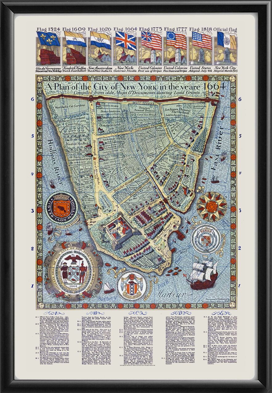
Restored plan of the city of New York in 1664 compiled from old maps & documents showing land ownership, with overlay of modern street locations and names, index of points of interest with descriptions, official seals of New Netherland, New York City, New Amsterdam, and New York state flags flying over New York over time. Produced by Franklin Bittner in 1929.


 Free shipping with $100 minimum order!


