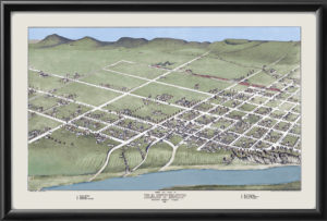
Restored Map of Houston Heights (“The Heights”) in Houston, Texas, 1891 showing a plat map of the newly developing area, a community park and an electric streetcar connecting it with downtown Houston, and vignette illustrations of various factories and residences of notable individuals.
