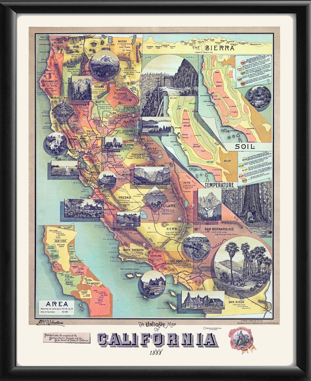
The Unique Map of California by E. Johnstone, was issued in 1888 by the Southern Pacific Railroad Company and the California State Board of Trade as part of a campaign to promote the economic, cultural, and natural advantages of California as a place in which to live and invest. The map covers the entire state, with insets showing temperature, soil, land area, and scenic images. Annual rainfall in inches is indicated by circled numbers across the map. An inset at the top shows a cross-section of the Sierra Nevada Mountains and the elevation in feet of some of the famous peaks (the heights differ from more accurate present-day measurements). The map charts the main existing rail lines (prominently including Southern Pacific Company’s routes), and emphasizes key products from various regions of California. An inset highlights the size of California, showing that its land mass is larger than that of ten other states combined. Vignettes highlight iconic scenes from the state, including both natural wonders and urban landmarks. Among the natural vistas shown are the Yosemite Valley, Lassen Peak, Mount Whitney, Lake Tahoe, the redwoods, and the Golden Gate. The images of famous California buildings presented include the Hotel del Coronado in San Diego, the Hotel del Monte in Monterey, and the State Capitol in Sacramento. Prominent railroad scenes are also included.